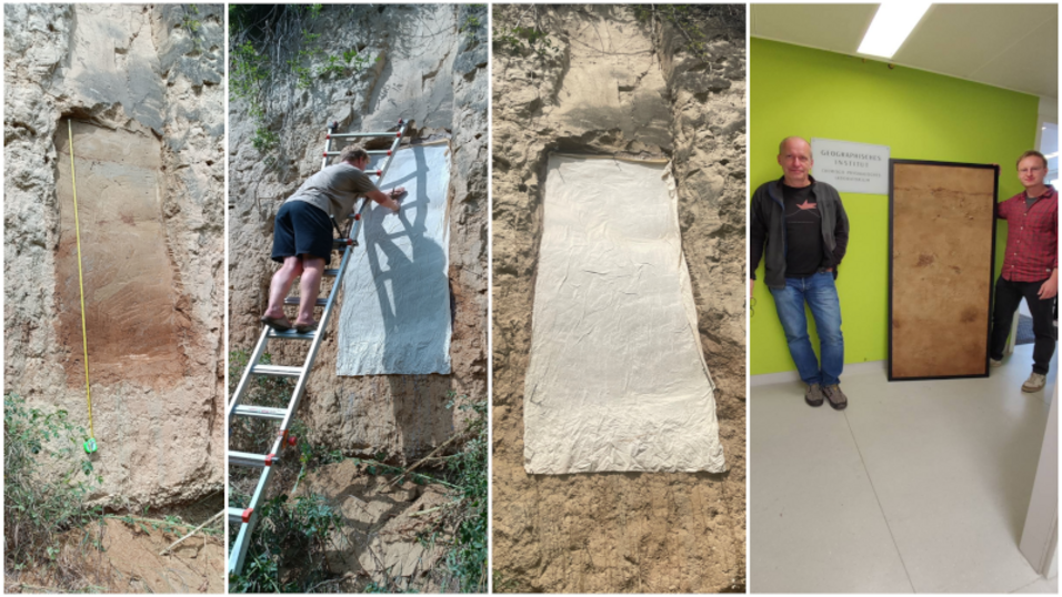
Both the presumed tephral layer (upper profile area) and the clay zone (lower profile area) are clearly recognisable in the profile shown.
In June 2023, a loess-palaeo-soil sequence (LPS) was recorded in the Zellergraben near Furth/Göttweig in the Lower Austrian Weinviertel using special coating. The Zellergraben, a hollow below Stift Göttweig, has been attracting scientists since the 1950s. A 6-meter high loess wall is exposed here, which shows the so-called Göttweiger Verlehmungszone, a palaeo-soil that formed during a warm period in the middle Pleistocene. In addition to the loess-paleosol sequence, a presumed tephral layer underlines the palaeopedological significance of the "Hohlweg Furth" profile.
Quaternary geological research on loess profiles in Lower Austria has been part of the profile of the Department of Geography and Regional Research for many years. Now, on behalf of the Lower Austrian provincial government, a coating has been produced that allows a profile of loess sediment to be taken from an outcrop in the correct position and presented in mirror image. The profile wall is cleaned and moistened. A special water-soluble coating is then applied to the profile using a paint gun. Finally, a cotton cloth with varnish is stuck to the impregnated loess wall. Once the varnish has hardened, a layer of loess approx. 5 mm thick can be removed from the profile wall together with the cotton cloth.

